


20200521 GR2 Les Andelys

Fabricecha
User
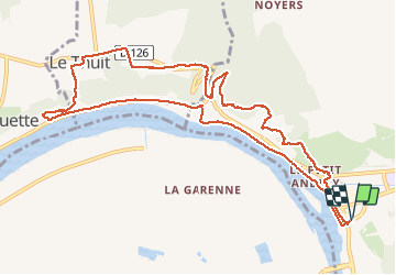

Length
11.1 km

Max alt
143 m

Uphill gradient
355 m
Km-Effort
15.9 km

Min alt
7 m

Downhill gradient
355 m
Boucle
Yes
Creation date :
2020-05-21 10:40:49.877
Updated on :
2020-05-21 14:11:53.526
3h04
Difficulty : Medium

FREE GPS app for hiking
 SityTrail
IGN / Geographical institutes
SityTrail Plus
The world is yours!
About
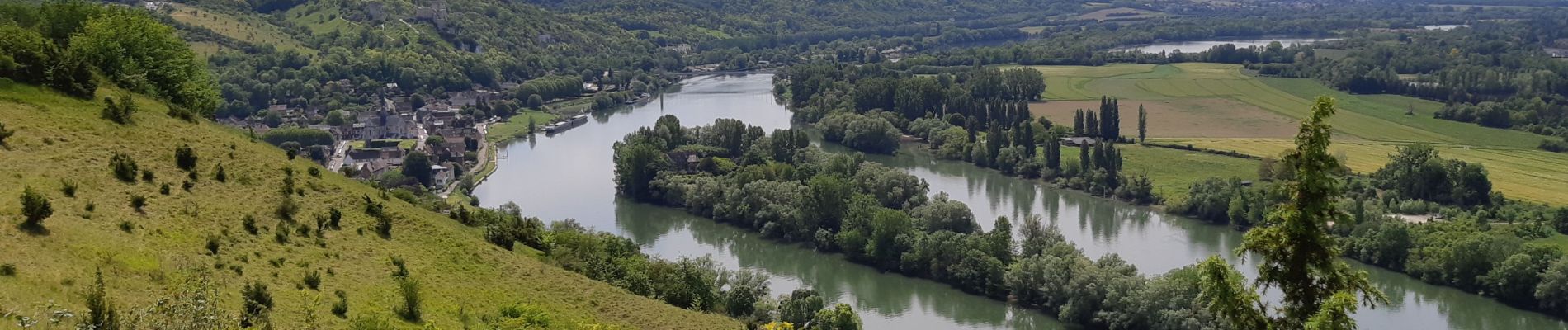
Trail Walking of 11.1 km to be discovered at Normandy, Eure, Les Andelys. This trail is proposed by Fabricecha.
Photos


Positioning
Country:
France
Region :
Normandy
Department/Province :
Eure
Municipality :
Les Andelys
Location:
Unknown
Start:(Dec)
Start:(UTM)
383641 ; 5455538 (31U) N.
Comments